|
|
|
CHALLENGING BACKPACK 18.1 miles 5700' elevation gain
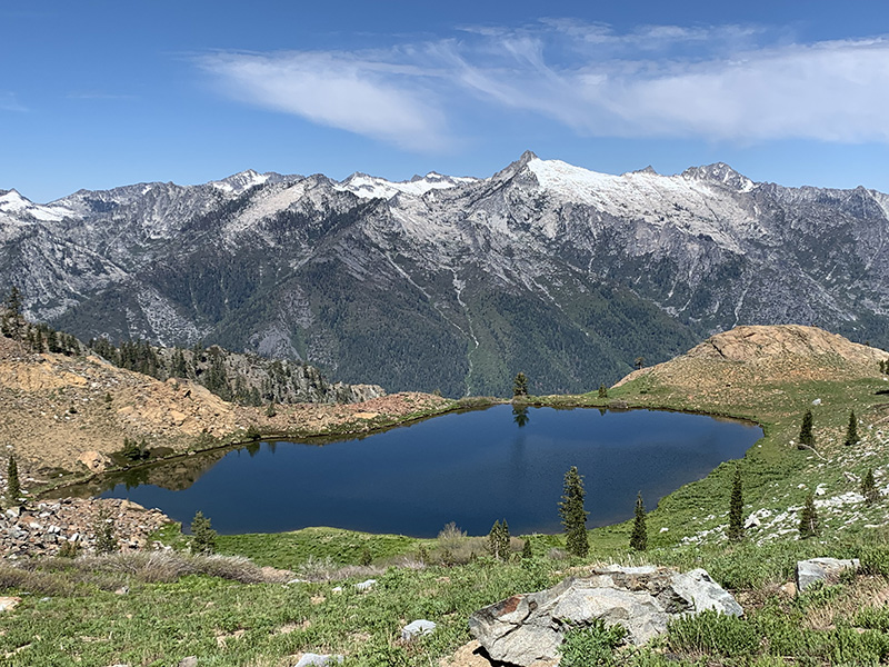
best season: 2:40 drive dogs welcome This hike heads continuously up and up Long Canyon with its forests, creeks, meadows, wildflowers, and crags, until you pop over the pass and arrive at Siligo Meadow. It is best to base camp at Siligo Meadows, and then hike the spectacular Four Lake Loop as a day hike. There is some limited camping available Summit Lake and Diamond Lake, but the sites may be taken. Excellent campsites in Deer Creek Valley, but that involves hiking down with your gear, and then having to hike back up the next day or two. The trails are generally well built and maintained. The passes are steep, and if there is snow they should only be attempted if experienced and equipped with ice axe and crampons. In dry years snow melts in late June, but may linger later in other years. The start of the hike can be quite warm. If weather prediction is for hot weather, it is recommended to arrive in early evening and hike in a short ways to one of the first campsites. And get an early start the next day to do the bulk of the climb in the cool of the morning. This is a popular hiking area so avoid holiday weekends. If the parking lot is less than filled, there should be good campsites available. Bears may be present and may like to eat your food. May want to bring a bear-proof canister. Wilderness Permits required, and can be picked up at self-service kiosks at Forest Service stations in Weaverville or Mule Creek Fire Station. A California Campfire Permit is required for campfires or gas stoves and can be obtained here. This hike is in Shasta-Trinity National Forest; owned by the public, managed by Shasta-Trinity National Forest. Backpacking welcomed; campfires welcomed except during campfire restriction periods. For this hike, there is a campfire prohibition zone depicted on the hike map by a red line where campfires are never allowed.
current weather
forecast: Maps (July 2022 edition)
|
 Avenza version
 Adobe PDF version