|
|
|
CHALLENGING DAY HIKE 9.9 miles 1,450' elevation gain
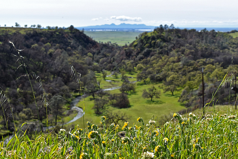
best season: 0:35 drive entry pass required for hikers During the rainy season, this hike will have at least 9 waterfalls. If you go within a few days of a major rainstorm there will be up to 14 waterfalls. Phantom Falls is 164' free-falling waterfall. Beatson Falls is 104' tall with much more water than Phantom. The hike is soggy if it has rained recently, and your feet will get wet unless you have waterproof hiking boots. Their beauty is fleeting. The major ones flow from the first storms in November through about April. A couple flow for only a few days after big storms. They are all dry throughout the summer. Eons ago, basalt lava flowed down a canyon and pooled in a valley at the end. There it slowly cooled, and as it crystallized fracture planes established vertically. Valley sediments underlay the basalt. The sides of the valley eroded away, leaving Table Mountain. The ancient valley's floor was soft alluvial deposits, and as they erode from underneath, the basalt cleaves vertically. Thus the vertical cliffs of North Table Mountain. If you are lucky and go on a hike after a big rainstorm in March, all the falls will be running and there will be millions of wildflowers carpeting the rocky flats. Expect to see grazing cattle; they are generally not dangerous, but give the occasional bull some space. Wildflowers best late Feb-April.
A smartphone (with backup battery), the Avenza app, and our Avenza map are highly recommended. Sunlight best on falls in early afternoon (many are facing west, and are in shade in the morning). This hike is in North Table Mountain Ecological Reserve; owned by the public, managed by California Department of Fish and Wildlife. No camping allowed. Maps (Feb 2025 version) |
 Avenza version
 Adobe PDF version