|
|
|
CHALLENGING DAY HIKE 12.5 miles 1,800' elevation gain
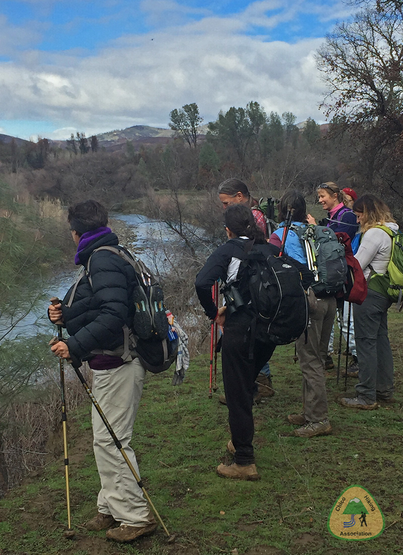
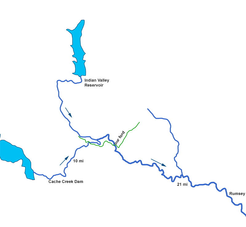
best season: 1:55 drive dogs welcome This hike traverses the lower elevation portion of the new Berryessa Snow Mountain National Monument., and makes two fords of Cache Creek. For more than half the year, Cache Creek is not fordable by the casual hiker. Carefully read the discussion on fording Cache Creek, below. Flowers peak in late April-early May. The grass becomes prickly mid May Trail has clay mud when wet; let dry for 3 or more days after rain before doing this hike. check recent rain here The trails are not continuous on either side of Wilson Valley, so smartphone with the Avenza app is recommended if not proficient with topographic maps. The area is hot May-October. The long walks along brushy ridges interspersed with grassy oak woodlands can be lovely in pleasant weather. we bring water shoes and a wading staff or trekking poles we
do not go if the combined dam releases are over 100 CFS
we do
not go if the flow at
This hike is in Cache Creek Natural Area; owned by the public, managed by Ukiah Field Office of Bureau of Land Management. Backpacking welcomed; campfires welcomed except during wildfire season.
Baton Flat campsite Use your own judgment. Be safe. Don't hesitate to return the way you came if conditions are dangerous.
Street View of trailhead Maps updated Apr 2021
|
 Avenza version
 Adobe PDF version
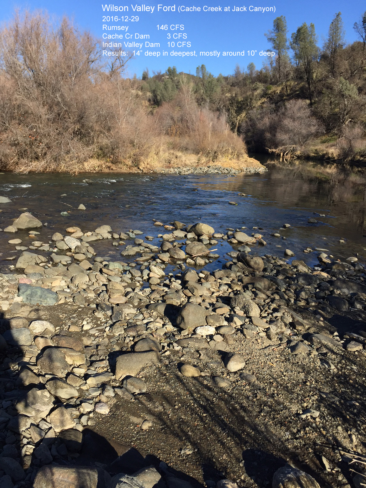